Have questions?
Call us : 1.888.292.0373
Get in touch
info@lavernewildfiresafety.org
La Verne Wildfire Safety Is A Proactive Response
Your support is needed to motivate our City leaders to immediately attend to the maintenance of their own land along with ensuring that private property owners do likewise.
Dear Neighbors
We are circulating this petition because the City property (the La Verne Wilderness Area) still represents a real wild land fire hazard very close to all our homes and neighborhoods. The goat grazing has reduced the dry grasses but that is only a part of minimizing the potential spread of a wild land fire. The photos included here show the deadwood, low hanging tree canopies and basically all the “kindling” that remain on this land. The City has responded to us, through their attorney, that goat grazing is all the fire “prevention” it will do on the City property / La Verne Wilderness Area. It has not removed the rest of the existing fire hazard shown in the photos below and this level of maintenance does not meet the City’s own standards for fire safety in the “City of La Verne Community Wildfire Protection Plan” (Feb. 2014) nor any standard set by the County of Los Angles.
Your support is needed to motivate our City leaders to immediately attend to the maintenance of their own land along with ensuring that all property owners do likewise. If you would like to see the location of your property and what fire zone applies, click the links below.
Please show your support by signing the petition below.
We hope that the strength of many voices will convince the City to do the right thing and provide fire safety for its residents and all our families
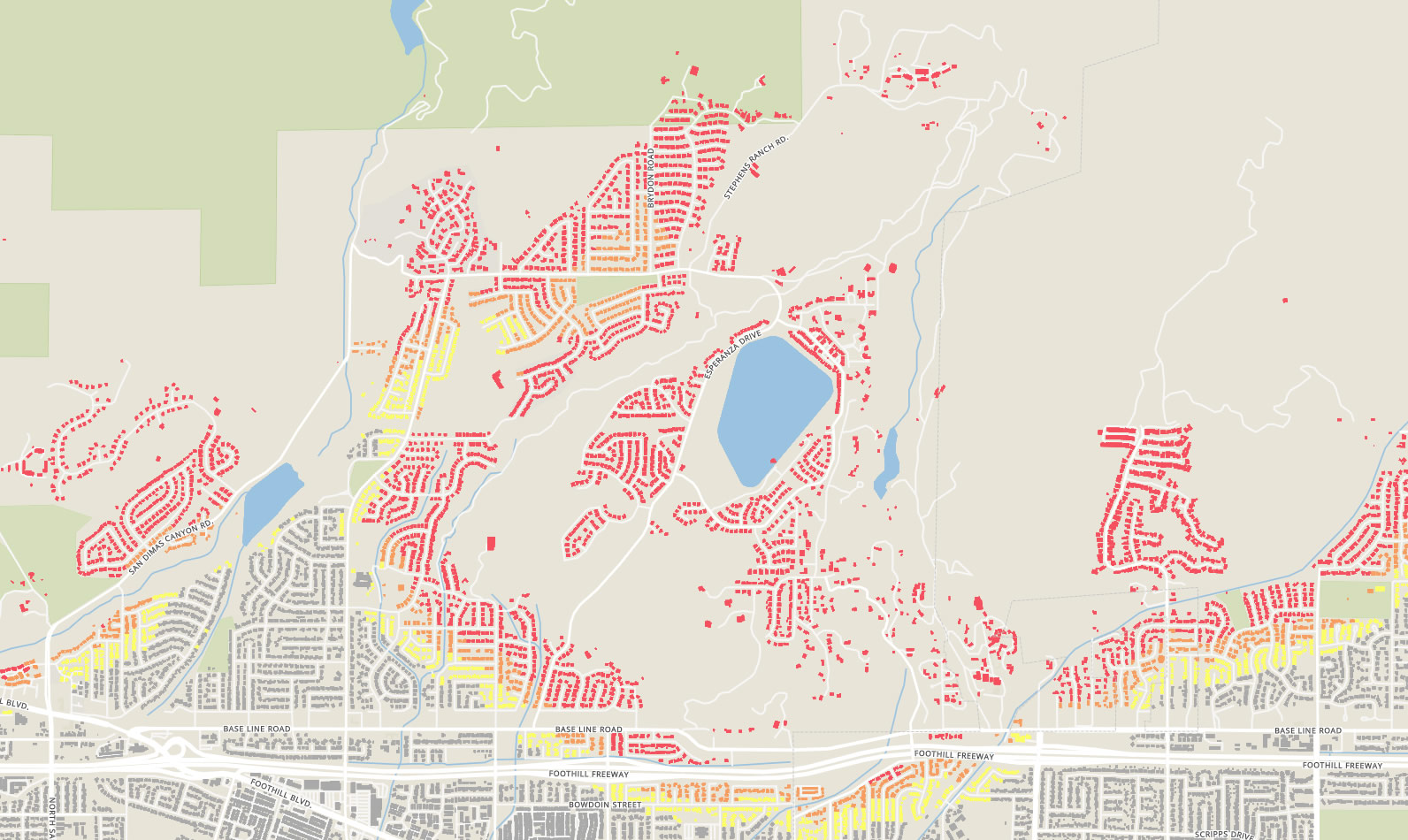
Fire Danger Zone | Map Overlay


Current Conditions In La Verne
June 2, 2020 after goat grazing Wilderness Area (dead trees standing & fallen, dead understory brush, debris)


Sign The Petition
Your support is needed to motivate our City leaders to immediately attend to the maintenance of their own land along with ensuring that private property owners do likewise.
1.888.292.0373
info@lavernwildfiresafety.org